Vietnam Dong Hoi Terrain
143km x 143km with 71,680 x 71,680 resolution satellite image from ArcGIS world imagery (2 meters / pixel).
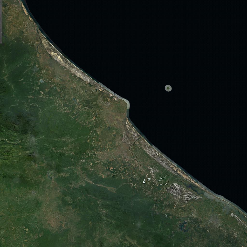
Terrain Specifications
Heightmap grid size: 4096 x 4096
Cell size: 35m
Satellite texture resolution: 71,680 x 71,680 pixels
Satellite surface mask size: 1024 x 1024 pixels
Texture layer size: 140m x 140m
Changelog
--- v0.1
- initial release

--- v0.1.1
- airfield 1 elevations leveled
- airfield 2 elevations leveled
- location names added
- openstreetmap road shapefile fixed.
- airfield temporary runway texture added (also in mapview)
- srtm 0m or below water depths fixed to 0.25m (actual ground)

--- v0.1.2
- ocean depths -5m to -50m fixed
- water creeping through land fixed

--- v0.2
- 7,918 vegetation objects added
Back to VTE terrains page.